
News Hub
The latest breaking stories
Access up-to-date news and information on a wide range of press releases including business, finance, technology, healthcare, entertainment, and more.
Discover the most important & comprehensive stories delivered directly to you daily.
- General News
- 05/03/2026
- 18:55
LiTime Launches 12V 320Ah Mini Bluetooth Lithium Battery for Australia’s 4WD and Caravan Power Needs
SYDNEY, March 05, 2026 (GLOBE NEWSWIRE) -- Within Australia’s 4WD and caravan community, users are increasingly seeking battery solutions that address limited space, strong output capability, and simplified system wiring.In response to these needs, LiTime has introduced its 12V 320Ah Mini Bluetooth lithium battery, designed to deliver high capacity in a compact form for mobile and off-grid power applications.Compact Size with 4096Wh CapacityThe mini battery delivers 4096Wh of energy in a housing measuring 38.4 × 19.4 × 24.8 cm, weighing approximately 25.93 kg.Compared with typical solutions on the market, the battery is:Around 31% smaller than a standard 300Ah lithium batteryAbout…

- Technology Innovation
- 05/03/2026
- 18:11
Cielo Advances Resilient Remote Connectivity for Its Nationwide Payment Terminal Fleet With Thales
Cielo, one of Brazil’s leading payment service providers, is piloting remote connectivity management for its point-of-sale (POS) terminals across the country, in partnership with…
- Contains:
- Travel Tourism
- 05/03/2026
- 17:21
RECORD SET STRAIGHT: AVIATION EXPERT DID NOT ADVISE AUSTRALIANS TO CANCEL EUROPE TRIPS
1600 Thursday 5 March 2026:The Australian Travel Industry Association (ATIA) and aviation safety expert Professor Ron Bartsch are jointly correcting media reports today that wrongly characterised his comments as a recommendation for Australians to cancel travel bookings to Europe for the next six months. Professor Bartsch's comments, reported in The Advertiser this morning, related specifically to the operational impact of Middle East airspace restrictions on flight corridors and fuel costs - not a recommendation to cancel future bookings. That critical distinction was lost in today's headlined coverage and subsequent re-reporting.. The facts are these: Etihad and Emirates are flying today.…
- Medical Health Aged Care
- 05/03/2026
- 17:11
Galderma Delivers Record 2025 Results With Net Sales of 5.207 Billion USD, up 17.7% at Constant Currency1, and Core EBITDA2 of 1.211 billion USD, Growing 18.9% at Constant Currency
Ad hoc announcement pursuant to Art. 53 LR ZUG, Switzerland–BUSINESS WIRE– Galderma Group AG (SIX:GALD), the pure-play dermatology category leader, today announced its financial…
- Contains:

- RetailOnline Retail
- 05/03/2026
- 16:57
The Estée Lauder Companies and Forest Essentials to Enter a New Chapter in Their Long-Term Partnership
Following Minority Investment, The Estée Lauder Companies to Acquire Remaining Shares in Forest Essentials Mira Kulkarni to Continue to Oversee Brand with Headquarters Remaining…
- Contains:

- Marketing Media
- 05/03/2026
- 16:41
The Next Global AI Trend Has a Face: Kindred Labs Partners With IPX (LINE FRIENDS, BT21) to Turn Characters Into Everyday AI
SINGAPORE–BUSINESS WIRE– Kindred Labs today announced a strategic partnership with IPX (formerly known as LINE FRIENDS), the globally recognized character brand LINE FRIENDS, BT21,…
- Contains:
- Finance Investment, Political
- 05/03/2026
- 15:55
SMC welcomes work starting on reforms to stop perpetrators inheriting their victim’s super
The Super Members Council welcomes the Government’s announcement today that it has opened public consultation on promised reforms to prevent family and domestic violence perpetrators from inheriting their victims’ superannuation death benefits. The Council has long championed reforms to close a loophole in super law that can enable a perpetrator to benefit financially from the harm they inflicted on a partner. Closing this legal loophole was among SMC's 12 key policy prioritiesthat the council asked all parties and independents to support to strengthen and safeguard people’s super. Under existing laws, a perpetrator can claim a spouse or partner’s super death…
- Contains:
- Government Federal, Indigenous
- 05/03/2026
- 15:21
Parliamentary Inquiry should look at workplace racism
Racism against First Nations people in the workplace should feature in the parliamentary inquiry into racism, hate and violence directed at Aboriginal and Torres Strait Islander people announced today, according to UTS Sydney’sCentre for Indigenous People and Work (CIPW). Director ofCIPW,Prof Nareen Young,welcomed the Inquiry as an important mechanism to explore the extent of workplace racism and recommend strategies to eradicate this. “Our research has found that racism against First Nations people in the workplace remains stubbornly prevalent,” Prof Young said. “At the current rate of progress, without further policy or legislative change, it could take another 118 years for…
- Political
- 05/03/2026
- 14:56
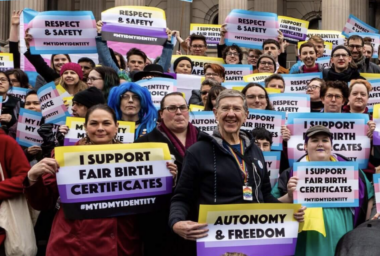
Liberals set to back special tax favours for radical gender lobby
The need for Family First was underscored by this week’s decision of Angus Taylor’s Liberals to wave through special favours for a radical LGBTQA+…
- Contains:
Media Outreach made fast, easy, simple.
Feature your press release on Medianet's News Hub every time you distribute with Medianet. Pay per release or save with a subscription.